Where You Can Fly a Drone in Spain: a guide to checking areas, restrictions and requirements before take-off
Before taking off with a drone in Spain, identify its characteristics, confirm your operating category and check ENAIRE Drones before the flight. An open location may be subject to aeronautical, environmental, temporary or other applicable restrictions.
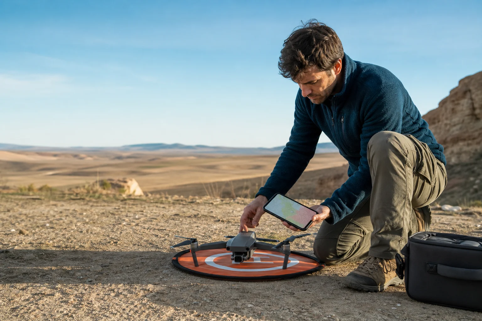
Flying for leisure still requires fitting into a category
The answer to “where can I fly a drone in Spain” cannot be determined simply by looking for an open field, few people or enough room to take off. Drones share a regulated environment with manned aviation and areas that may have environmental protection, public safety restrictions or temporary limitations. As a result, a location that appears suitable may not be suitable on the intended date, at the intended time or at the intended height.
Recreational use is not automatically exempt from European rules. For low-risk operations, the usual reference is the open category, which is divided into the A1, A2 and A3 subcategories. You may only operate in this category if all of its conditions are met; leisure, photography or video purposes do not replace those requirements.
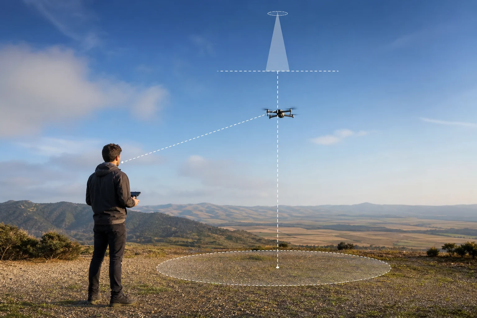
As a starting point, the open category covers UAS with a maximum take-off mass of less than 25 kg. It also requires keeping a safe horizontal distance from people, not flying over assemblies of people, keeping the drone within visual line of sight —VLOS— and respecting a maximum height of 120 metres from the closest point of the Earth’s surface. These conditions are in addition to those imposed by the specific geographical area.
- Do not decide based on how the land looks: check the airspace and applicable restrictions.
- Recreational flying may fall within the open category, but only if it meets all of its limits.
- Not flying over assemblies of people, maintaining VLOS and staying below 120 m are basic controls.
- The intended height and location must be assessed together.
Start with the drone: C class, mass and subcategory
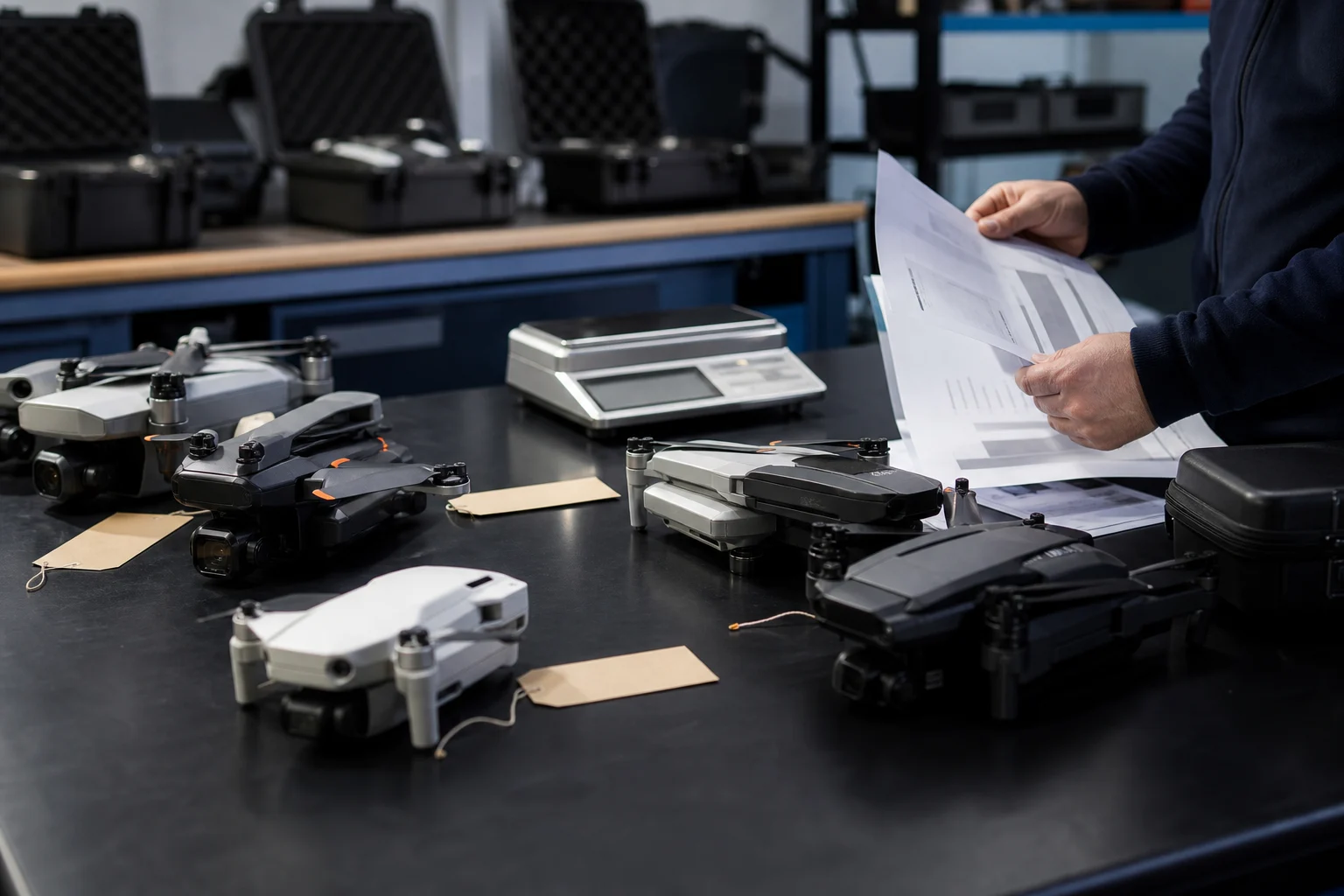
Before looking for a location, check your equipment’s technical specifications and physical labelling. Note its C class —C0, C1, C2, C3 or C4, where applicable—, its maximum take-off mass or MTOM, and whether it is a model without a class marking, commonly referred to as legacy. These details determine which open subcategory may apply and, therefore, the distance you must keep from people and certain areas.
Legacy models have different rules. According to AESA, a UAS that is not privately built and does not belong to classes C0 to C4 may be used in A1 if its MTOM is below 250 g; if its MTOM is below 25 kg, it may operate in A3 under that subcategory’s conditions. You should not infer the subcategory solely from the drone’s apparent size or how it was marketed when purchased.
The practical difference can be decisive when choosing a location. In A2, you must maintain a horizontal distance of at least 30 metres from uninvolved persons. In A3, in addition to not endangering uninvolved persons, you must maintain a minimum horizontal distance of 150 metres from residential, commercial, industrial or recreational areas. A park, a busy beach, a housing development or a leisure area are therefore not equivalent to a secluded plot of land.
- Find the C class label and check the manual or technical documentation.
- Note the MTOM, not just what you think the aircraft weighs.
- If the drone has no C class, check whether it falls under the legacy regime.
- Link A1, A2 or A3 to the distances from people and from inhabited or recreational areas.
Registration and training: confirm them before planning the flight
Operator registration may be mandatory even for lightweight equipment. In the open category, AESA requires it, among other cases, when the UAS has an MTOM of 250 g or more and when it is equipped with a sensor capable of capturing personal data, unless it is a toy compliant with Directive 2009/48/EC.
If you must register, the generated operator number must be displayed on all of the operator’s drones. It is an easy detail to overlook when a new piece of equipment is being used, more than one aircraft is operated or the drone is shared within a family, but it is part of the pre-flight check.
Remote pilot training does not depend solely on whether the flight is recreational. AESA states that it varies according to the aircraft’s characteristics and the subcategory. For A1/A3, the Agency provides free online training and an examination. If you need to operate in A2, confirm the applicable requirements in AESA’s up-to-date information before travelling.
There is a clear route for cases that do not fit: if the intended operation does not fall within the limits of the open category or a published standard scenario, authorisation from AESA is required before operating. Changing location, moving a few metres away or declaring the flight recreational does not automatically make an inadmissible operation an open-category operation.
- Check whether your drone requires operator registration due to its mass or because it has a sensor that captures personal data.
- Display the operator number on all your drones if you are required to register.
- Determine the required training according to the drone and subcategory; AESA provides online training and an exam for A1/A3.
- If you need to operate in A2, confirm the applicable requirements.
- If you do not fit within the open category or a standard scenario, do not fly without the required prior authorisation.
ENAIRE Drones: the pre-flight check for every location and flight
The official pre-flight consultation tool is ENAIRE Drones. Its purpose is to show UAS geographical zones and other notices needed to plan operations safely. It should be used before choosing the location and checked again close to the time of the flight, as a location that was suitable the previous week may later be affected by a temporary development.
Do not limit yourself to checking whether the point appears in a seemingly favourable colour. Open the information associated with the area and compare the affected volume of airspace with your actual plan: take-off point, route, maximum height and time. Geographical zones may overlap. When several general zones coincide in the same volume of airspace, the rule requires compliance with the operational conditions of all of them, not only those of the layer that appears most restrictive or most visible.
Pay particular attention to NOTAMs. ENAIRE Drones identifies them as temporary notices and shows their start and end dates, times in UTC, height or altitude, and the content of the notice. If the flight is planned for the afternoon, reading the date is not enough: check the conversion between the stated UTC time and local time, as well as the full period of validity.
The official consultation is a planning tool, not universal authorisation. The fact that an area does not show a complete prohibition does not remove open-category limits, the specific conditions stated for a zone or other rules applicable to the operation. As a precautionary measure, it may be useful to note the relevant details from the consultation for review before take-off.
- Search for the exact take-off point and the area where the drone will actually move.
- Read the details for each zone and check its vertical limits and conditions.
- Review overlaps: restrictions are cumulative.
- Check NOTAMs and verify dates, UTC times, height and the scope of the notice.
- As a precautionary practice, check the information again close to the flight time, especially if it depends on a specific hour.
Restrictions that often completely change a flight plan
The surroundings of civil or military aerodromes and heliports are UAS geographical zones for operational safety reasons. Their horizontal and vertical limits are defined by regulations, so you should not calculate them by eye or rely exclusively on the distance to an airport terminal. Check the official mapping and its specific conditions before taking off.
Prohibited or restricted zones linked to Defence, national interests or public safety may also apply. There are also areas restricted for environmental protection, restrictions on aerial photography and structures associated with flexible airspace management. The fact that a location can be reached on foot or by car does not mean it is available for drone flight.
Temporary notices are another critical point. An active NOTAM may change the conditions of an area for the period it specifies. A common mistake is planning from an old screenshot, a third-party map or advice received on social media. None of these replaces current verification through official channels.
Finally, separate two questions that are often confused. First: does the UAS geographical zone allow this operation, and under what conditions? Second: does the operation fit within the limits of the open category or a published standard scenario? If it fits neither of those situations, authorisation from AESA is required before operating. Compliance with a geographical zone is understood to be without prejudice to the other provisions applicable to the operation.
- Do not estimate the impact of airports, aerodromes or heliports by eye.
- Check environmental protection, public safety, Defence and potential photography restrictions.
- Do not rely on unofficial maps as your only source for a decision.
- Distinguish between geographical zone conditions and operational category requirements.
Flight plan and final checklist before take-off
Useful planning fits in a short note, but it must be precise. Write down the exact location, date, local time slot and its UTC equivalent when checking notices, the planned maximum height and the area where the drone will fly. Add the C class or legacy status, MTOM, applicable subcategory and the distances you will need to keep from people or nearby areas. This will help you identify before leaving whether a location does not fit A2 or A3.
When you arrive, confirm again that the real scenario matches the planned one. The presence of uninvolved persons, a recreational activity, actual proximity to a residential area or a change in time can mean that the plan no longer meets its conditions even though the map point remains the same. In that case, the prudent option is not to take off or to move the flight to a location where all requirements can be met.
The key is not finding a green area or an empty field, but showing that your aircraft, operation, location, time and height are compatible with each other. The Royal Decree states that compliance with a geographical zone is understood to be without prejudice to the other provisions applicable to the operation. This is why the check must be complete, not selective.
- Before leaving: identify the C class or legacy status, MTOM, subcategory, required registration and training.
- Note the exact coordinates or address, date, local time, UTC if there are NOTAMs, planned height and route.
- In ENAIRE Drones: check zones, conditions, overlaps, vertical limits and temporary notices.
- As a precautionary measure, review ENAIRE Drones information close to the time of the flight.
- At the location: confirm that there are no assemblies of people and that you can maintain VLOS and the required distances.
- Check that you do not exceed 120 m from the closest point of the Earth’s surface.
- Verify whether the operation fits within the open category or a published standard scenario.
- If any condition is unclear or you cannot meet it, postpone the flight and consult AESA or ENAIRE Drones through their official channels.
Can I fly a drone in Spain if I only use it for leisure?
Yes, leisure use may fall within the open category if the operation meets all of its conditions. Recreational use does not remove limits on mass, height, visual line of sight, distance from people or geographical restrictions.
Where should I check restrictions for flying a drone?
Check ENAIRE Drones before planning the flight. It is the official channel for viewing UAS geographical zones and other notices, including temporary NOTAMs. As a precautionary practice, it is advisable to check the information again close to take-off.
Can I fly near an airport or heliport?
The surroundings of aerodromes and heliports are UAS geographical zones for operational safety. You must check the specific limits and conditions in ENAIRE Drones; estimating them visually is neither safe nor sufficient.
Is it mandatory to register a drone weighing less than 250 grams?
It may be. AESA requires registration, among other cases, if the drone has a sensor capable of capturing personal data, unless it is a toy compliant with Directive 2009/48/EC. Confirm your case through AESA’s operator registration.
Does an area without a prohibition on the map mean I can take off?
Not automatically. You must comply with open-category conditions, all overlapping geographical zone layers, temporary notices and the other provisions applicable to the operation.
What is the maximum height in the open category?
The maximum flight height is 120 metres from the closest point of the Earth’s surface, in addition to any lower limit or additional condition applicable to the geographical zone.